The clock is ticking toward the deadline for developers to present their proposals for the redevelopment of four properties strategically located next to the Metro-North Railroad station in downtown White Plains.
Responses to a request for proposals (RFP) are due at the city”™s Planning Department by 4 p.m. on Nov. 1. The city will then evaluate the submissions and decide what it wants to do. As is typical for RFPs, the one issued by White Plains for the four properties contained a few escape clauses.
“This RFP is not intended and shall not be construed to commit the city to procure or to contract for any services,” the RFP stated. “The city reserves the right, without prior notice, to supplement, amend or otherwise modify this RFP, or otherwise request additional information or to withdraw this RFP at any time.”
Three of the four parcels in the Transit District RFP are owned by the city. The fourth one is owned by the White Plains Urban Renewal Agency. Together, they make up approximately 4.5 acres along the east side of the railroad station.
The Transit District is a circular segment of the city”™s downtown core that encompasses the area going out one-third of a mile from the train station.
“There is a great deal of interest in our Transit District, which is gratifying, but not surprising,” Mayor Tom Roach told the Business Journal. When the city held an information session on June 27 aimed at those who might want to submit a response to the RFP, more than 80 people attended.
“In the information session we shared the importance of any project being environmentally progressive, providing affordable housing and street-level retail, as well as improving the pedestrian and bike experience and connections to the rest of our downtown,” Roach said.

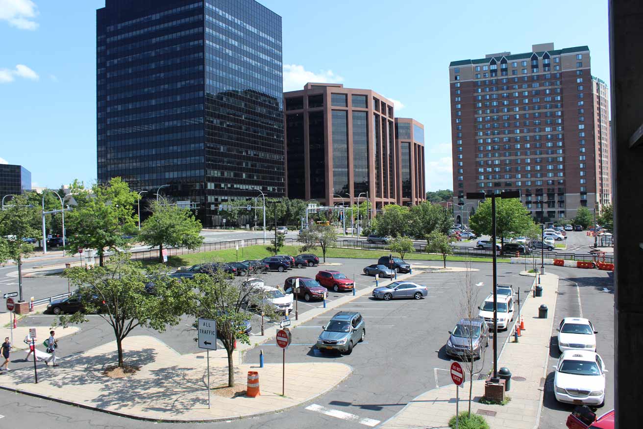
Southernmost of the parcels up for redevelopment is the Urban Renewal Agency”™s lot at 3 Hamilton Ave., currently being used as an at-grade parking facility called the Bronx Street Lot. It is bordered to the north by Hamilton Avenue, the south by Main Street, the east by Bank Street and on the west by the train station. It covers about 40,500 square feet. A strategic plan for the area envisioned a mixed-use development for the site incorporating retail, commercial and entertainment uses at ground level.
The second parcel is at 10 Ferris Ave. and is known as the Station Lot. It is 37,500 square feet and used for passenger drop-off, taxicabs waiting for riders and limited surface parking. It is bordered on the south by Hamilton Avenue, on the north by a driveway, on the east by Ferris Avenue and on the west by Metro-North. The strategic plan called for development concepts to maintain or enhance existing at-grade circulation patterns and station access.
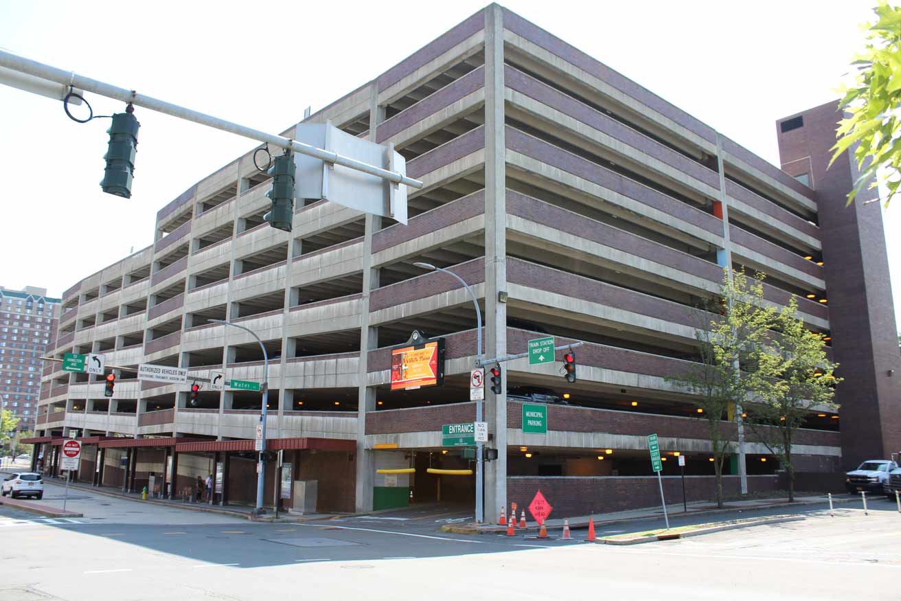
Parcel 3 is at 16 Ferris Ave. and is the site of the current parking garage. It covers 40,000 square feet with driveways on the south and north, Ferris Avenue on the east and the train station to the west. Development concepts could include incorporating the existing structure into a new development or tearing it down provided new parking is created somewhere else.
The fourth parcel, 20 Ferris Ave., is 72,500 square feet and is where the city has a firehouse. Ferris Avenue borders the property to the east and north with Metro-North to the west and a driveway to the south. The strategic plan states that the firehouse doesn”™t have to stay in its current location and that the city is evaluating options to build a firehouse in the immediate vicinity of the development site.
“We are channeling this high level of interest into developments that will benefit the city overall, bringing street life back to an area of the downtown that lost its vitality due to urban renewal,” Roach told the Business Journal.
The development site is zoned CB-4, with CB standing for core business. It permits residential, retail, office, government, business, service, cultural and entertainment uses. High-rise, high-density housing can be built on sites greater than 50,000 square feet where 50% or more of the floor area ratio is used for residential. The maximum building height would be 280 feet.
The RFP requires developers to identify “the location, size and intended use/programming of an at-grade community green, park or open space.” As an alternative, developers could propose creating an elevated linear open space, similar to New York City”™s High Line, possibly spanning Main Street and Hamilton Avenue and providing additional pedestrian access points to the train station platforms.
City planners view the redevelopment of the train station parcels as an opportunity to improve pedestrian connections between the area and adjacent neighborhoods including Battle Hill, Fisher Hill and Ferris Avenue as well as to reinforce the existing connection along Main Street to the rest of the downtown area.


